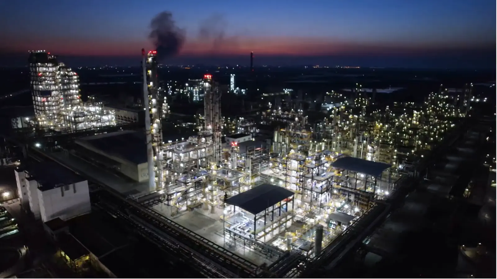
In use today
Ask, draft, model, see, and watch. On your own facility's record.
Already at work at some of the largest industrial and petrochemical companies in the world, on their own facilities and permits.
Think of it as the environmental version of the AI assistants people now use for everything else, with one difference that changes what it can do: it is tied directly to the environmental record, live Earth data, and the map of every facility. It is one system, not a bundle of tools: everything below draws on the same record and the same facility data.
It does not sign.
EnviroAI does not replace the responsible professional's review, and it does not hide where an answer came from. Every answer cites the document it came from. Every permit draft marks the values it could not confirm instead of guessing them. A person checks the sources and makes the call, because the people who use it are the ones whose names go on the submittal.
01
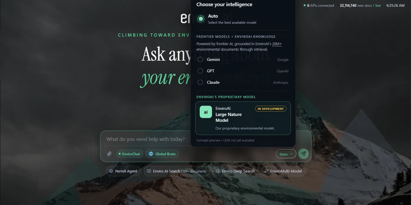
Ask
Get a sourced answer to any environmental question.
"What does our permit actually allow at that stack, and what did the agency say about it last time?"
About a facility, a rule, an agency action, or a document you upload. The answer shows where it came from.
- Enviro Chat
- EnviroMulti-Model
- Enviro Deep Research
- Enviro AI Search
02
Permit
Prepare, analyze, and review permits and deviations.
"We need the registration drafted by Friday, and I do not want a number in it that nobody checked."
Load a permit application, a Title V deviation (a report that an operating permit condition was not met), or a New Source Review (NSR) question (the air-permitting review for new or changed sources) and work it through with the record attached.
- Permit Agent
03
See
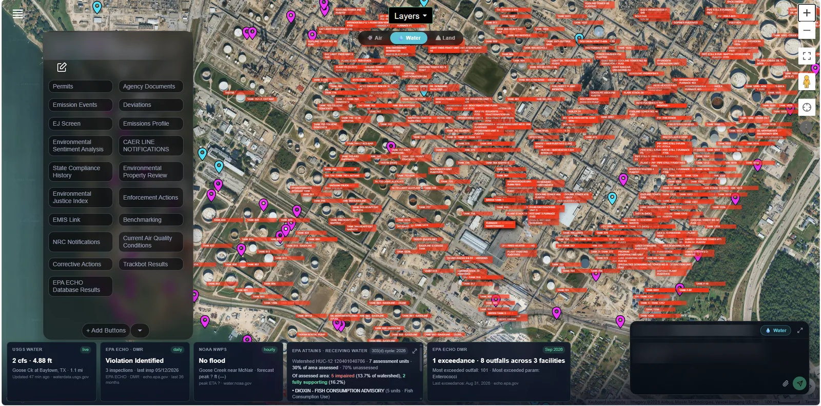
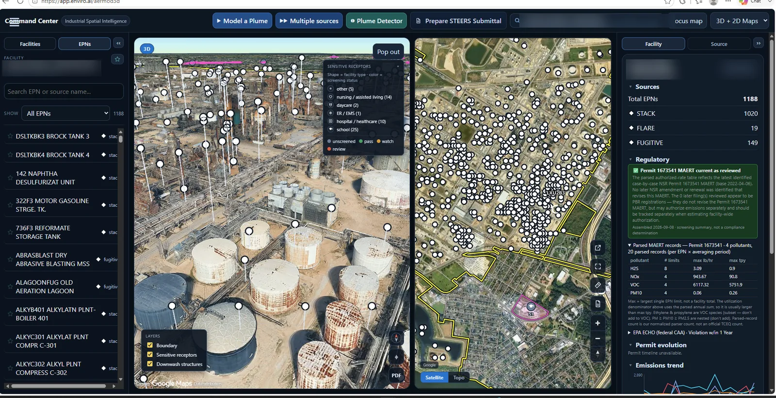
Open a facility, from satellite view to each emission point.
"Show me the plant the way the agency sees it: every permitted point, and what is attached to each one."
Permits, limits, and records attached to the place they belong to.
- My Facilities
- AI Earth
04
Model
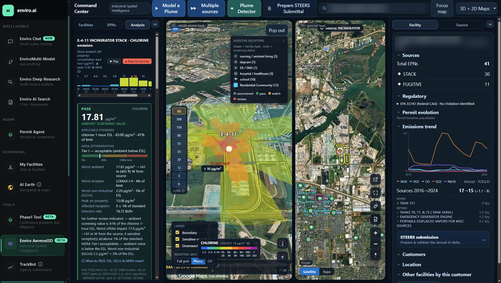
Run a 3D air dispersion model and prepare a submittal.
"If that flare runs all night, what reaches the fence line, and is it under the screening level?"
Air dispersion modeling (how a release spreads through the air) in three dimensions over the real plant, using AERMOD, the model the EPA and the states use for permits: model a plume, place several sources, and prepare what the agency needs. A person reviews the run before anything is submitted.
- Enviro Aermod3DBeta
05
Watch
Track agency submissions as they are filed.
"Tell me the day the agency files anything that mentions our plant, our competitor, or that rule."
Keywords, facilities, and agency activity, watched as agencies file so fewer things arrive as a surprise.
- TrackBot
The work people bring to it.
Six kinds, with examples. Some of this the system does, some it drafts, some it assists; the share it does grows with each release, and the examples are only that.
-
01
Questions
- what a permit allows at one stack
- which rule applies to a new unit
- what the agency said last time, with the letter
-
02
Permits
- a first draft of the application package from one sentence, every unconfirmed value flagged
- a deviation report (a report of a departure from a permit condition) drafted from the record
- the conditions in a current permit, read and compared with the rule
-
03
Audits and reviews
- limits against twelve months of monitoring reports
- exceedances found and explained
- a dated plan to close them
-
04
Modeling
- a release in three dimensions over the real plant
- the schools and clinics in range
- a result against the state screening level
-
05
Watching
- filings from the agencies you pick that mention your plant
- a competitor, a customer, or a rule
- ninety days of history, with an email alert
-
06
Comparing
- one plant against its company
- a company against its industry
- from the agencies’ own enforcement data
Three kinds of data, kept together.
The record
22 million documents: permits, permit applications, agency correspondence, enforcement actions, deviation reports, and the regulations they cite, indexed across twenty states (California in part), two Canadian provinces, and federal sources, and growing as agencies file. About 22 million as of October 2026.
Live feeds
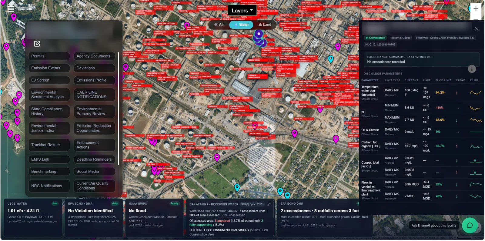
Six connected feeds: ambient air quality, weather, stream flow, and federal enforcement and compliance data among them, so an answer uses the latest records the agency has published, with their dates shown. A report retrieved today can describe a period measured months ago; the date is part of the answer. Coverage and methods.
Place
Each facility as a map: its boundary, its emission points with their permitted limits, nearby receptors and structures, and the satellite view, so a question can be asked about a specific stack, not just a company. Built for every facility in Texas and Louisiana today; the other states follow.
Your work stays yours.
The public record is shared by everyone who uses the system. What you upload and what you ask are not: a customer's documents, questions, and drafts stay inside that customer's own workspace, are not visible to any other customer, and are not used to train the shared environmental brain.
Ask us for the written data-handling terms before you upload anything confidential; do not send confidential facility material through the general contact form.
See it on your own facilities.
A demo runs on the public record of a facility you choose. Thirty minutes, no slides.